Story Maps – How telling a good story helps your business
Everyone has a story to tell. ESRI Story Maps let you combine authoritative maps with narrative text, images, and multimedia content. They make it easy to harness the power of maps and geography to tell your story. With no coding skills required, Story Maps are an incredibly powerful source to share and showcase your plans, projects or engaging with your community and customers.
 The presentation was about the “Evolution of Queensland’s Borders Story Map” which is a pilot project to develop and deliver an informative, engaging and inspiring interactive spatial version of the existing Queensland Borders Story.
The current version of the story of the border surveys between Queensland and New South Wales in Australia is mostly textual information displayed in the departmental website with many sub-pages and very little images or maps. Felicia’s work has put a spatial context to the exciting border stories and allows one to join the early explorers both spatially and visually.
Story Maps are an ESRI Web Mapping Application that has the potential to engage and inspire its audience by mashing web maps with text, images and video content. There is no requirement for any coding skills – it has a simple easy to use editor.
The story map that Felicia presented demonstrated a beautiful example of an application that combines spatial and non-spatial data to tell compelling stories. It could be used by any spatial businesses to pitch their spatial stories.
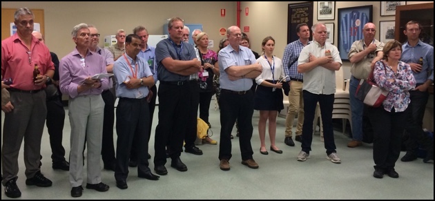
This story and the potential application and the ease of use resonated with the audience. There were many questions, suggestions and discussions where all the audience including representatives from ESRI participated.
Felicia’s tips for considerations on creating a Story Map include: consider the audience – fit for purpose or the best tool for one’s requirements; content – story content development including content IP is the most time consuming part; data management – hosting in ArcGIS Online or own server; ongoing maintenance – be ready for the commitment; and time constraints: very difficult to tell how long it would take.
 Felicia Andrews is a Spatial Information Officer with the Queensland Department of Natural Resources and Mines. Felicia has recently been working with ESRI Story Maps, which use spatial information to tell a story.
Felicia has worked in various spatial roles within flood and tsunami emergency management and planning, biodiversity planning, wetland and vegetation mapping and satellite imagery services across Western Australia, New South Wales and Queensland Governments.
Felicia holds a Bachelor of Science in Australian Environmental Studies from Griffith University and a Graduate Diploma in Geographic Information Systems from Queensland University of Technology.


