In February 2022, the National Geospatial Program (NGP) launched the topoBuilder application as a pilot capability for the public. This free, customizable, topographic mapping capability enables everyone, regardless of their level of map or data expertise, to build customized on-demand topographic maps from reliable and authoritative data in The National Map.
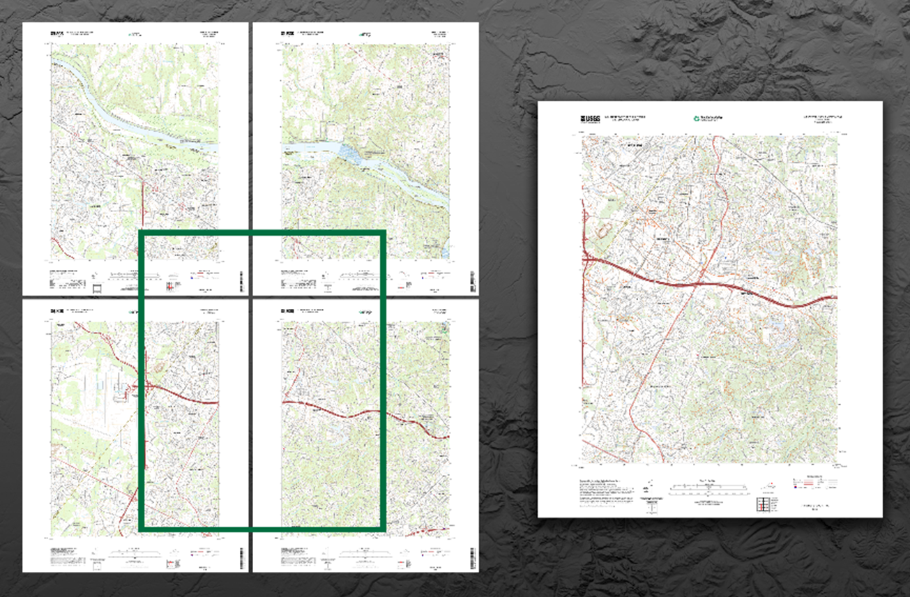
Figure 1 Reston, Virginia 4 US Topo Quadrangles (left) compared to 1 custom-centered OnDemand Topo (right). Credit: U.S. Geological Survey
Thanks to a highly successful pilot project, OnDemand Topo maps will become a permanent National Map offering. Starting January 2023 topoBuilder and OnDemand Topo maps joined US Topo as a standard offering from the NGP, along with downloadable geospatial data for boundaries, elevation, geographic names, hydrography, land cover, orthoimagery, structures, and transportation.
Exclusive to the topoBuilder application is the ability to center maps where users choose within the United States and territories. OnDemand Topo map extents do not need to align with the traditional grids used by other USGS topographic maps, so one map can cover an area that would have previously required up to four maps.
Users can then choose their preferred file format (georeferenced PDF or TIFF) as well as the level of contour detail to best suit their needs. OnDemand Topo contours are generated on the fly from the latest USGS elevation data available from the 3D Elevation Program (3DEP). The Edit Layers functionality allows users to select which data themes they would like included in their maps for their unique purposes. Once the customizations have been set, users simply enter a valid email address and a direct link to download their unique map product will be delivered free of charge within five days.
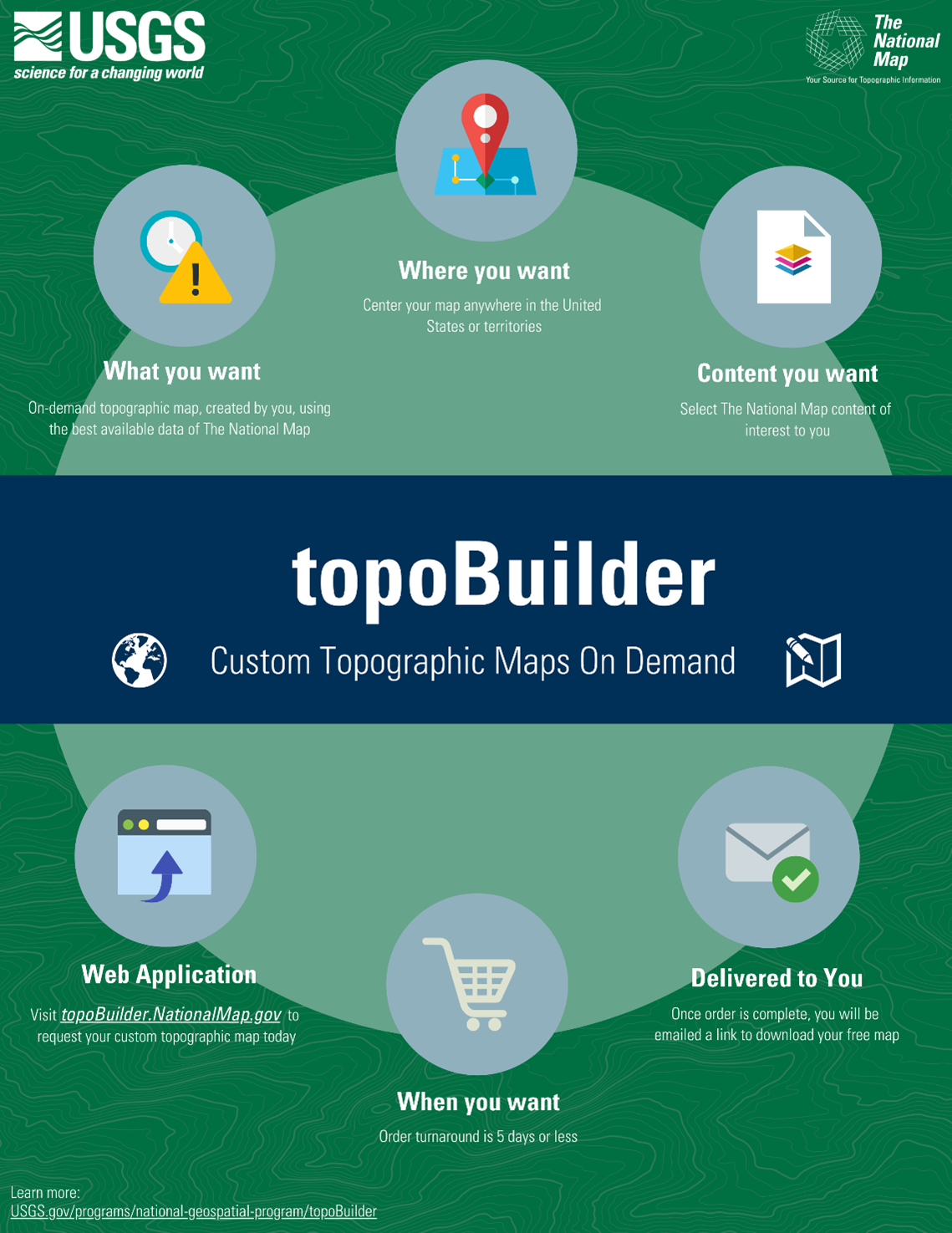
Figure 2 topoBuilder custom topographic maps on demand. Credit: U.S. Geological Survey
In the months since topoBuilder’s pilot release, almost 190,000 OnDemand Topos have been delivered to more than 50,000 customers across every state and territory in the U.S. Feedback received on topoBuilder and OnDemand Topos has been overwhelmingly positive. Users have described the application and maps as “outstanding” and “easy to use.”
More than 70% of all maps have been delivered within 24 hours, with a peak of nearly 2,800 maps delivered in a single day. The first few weeks after the pilot launch saw an extraordinary level of interest in topoBuilder and enthusiasm continues with approximately 5,000 unique users served each month and over 550 map requests received each day.
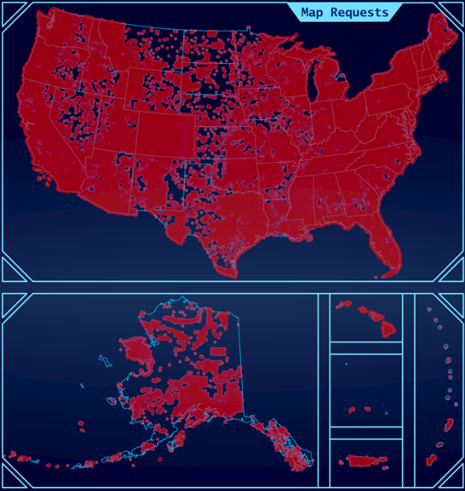
Figure 3 Map view of topoBuilder requests (in red) from February 2022 thru Dec 2022 covering most of the coterminous United States, Alaska, Hawaii, Puerto Rico. the US Virgin Islands, and the Mariana Islands. Credit: U.S. Geological Survey
TopoBuilder remains in active development. Enhancements to the application are in the works. Efforts to deliver maps even more quickly into the hands of users are also ongoing. In addition to the currently available 7.5-Minute Topo, maps of other types and scales are planned for future releases, and work has already begun on a 1:100,00-scale map product. Coming in early 2023, the 1:100,000-scale map expands the use of OnDemand Topos to many additional use cases by providing individual topographic maps over larger areas. It is an exciting and unprecedented undertaking by the NGP.
Whether historic, current, or the next generation, the topographic map remains an indispensable tool for everyday use in government, science, industry, land management planning, recreation, and many more applications. Be a part of the future of USGS topographic mapping and visit topoBuilder.NationalMap.gov today to build your customized OnDemand Topo!