
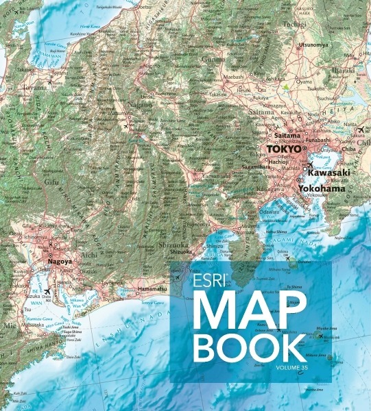
Congratulations to IMIA members Benchmark Maps on the selection of their map of Japan for the cover of the 2020 Esri Map Book! This large, general reference map of Japan used a variety of datasets and was edited with the help of a nine-person, native-speaking editorial team in Japan who combed over printed tiles of the map, providing several hundred edits and comments that greatly improved the map’s accuracy (including spelling and elevation input).
The maps in Esri® Map Book Volume 35 provide examples of how the use of digital geography helps us see what others can’t. From migratory patterns of monarch butterflies in the US to solar panel suitability in Puerto Rico, the data and spatial analytics developed from these works show the growing geospatial infrastructure that represents our world in digital forms.
More details on Benchmark’s Map of Japan:
- The Transverse Mercator map projection was rotated 8° to encompass all of the mainland and most of the Japanese offshore islands.
- At one-quarter of the scale (1:7,200,000), the inset map was necessary to keep the main map scale as large as possible.
- Vertical exaggeration was multiplied to visually dramatize the landscape and to emphasize the extraordinary geography of the Land of the Rising Sun.
- Land cover was chosen to idealize the landscape in conjunction with the terrain. Similarly, bathymetric colors were chosen to help highlight the rugged breadth of features at depth.