The second session of the Forum, held on Sept. 23, focused on trends and issues in the recreation world. Sponsored by National Geographic, the panelists were: Greg Matthews, UE Published Maps Products & Services Focus Area Coordinator, USGS; David Lambert, Director of Cartographic Production, National Geographic Maps; Nathan Copeland, Gaia GPS; and Neil Allen, Director of Cartography, Benchmark Maps.
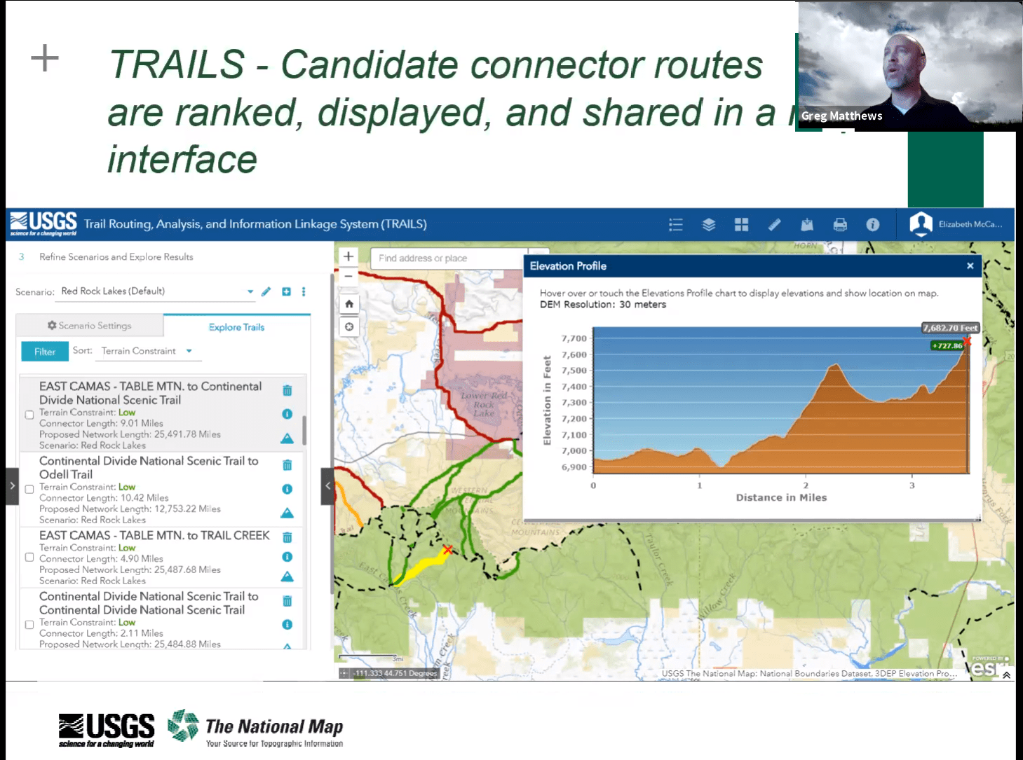 Matthews kicked off the session discussing the National Digital Trails project at the USGS.
“This initiative was launched in 2018 to increase public access to land, and to provide better connectivity on the nation’s trail systems by providing data and tools,” explained Matthews, with the goal of “enabling land managers to visualize opportunities to increase connectivity within this network, expanding recreational opportunities.”
The project looks to fulfill three primary goals: first, develop a web-based decision support tool that will automatically identify possible routes for connecting existing trails together; second, develop good digital trails data that shows existing trail systems with the USGS geospatial program; and third, develop tools in conjunction with agencies that manage trails to maintain the trails data.
“Our concept is to use a mobile application so that people in the field can provide updated information about trails,” said Matthews.
Lambert talked about the new efforts to refresh National Geographic’s original recreation flagship map series Trails Illustrated. The company has made some recent production decisions that have helped to shape a new day-hike product series, which covers national parks and other recreation areas all across the U.S. and Canada, an essential tool for those planning recreation trips in the back country. While the content and styles have evolved over the years (for example, moving from a flat map format to saddle-stitched booklet), the one constant is keeping the needs of the outdoor enthusiast in mind.
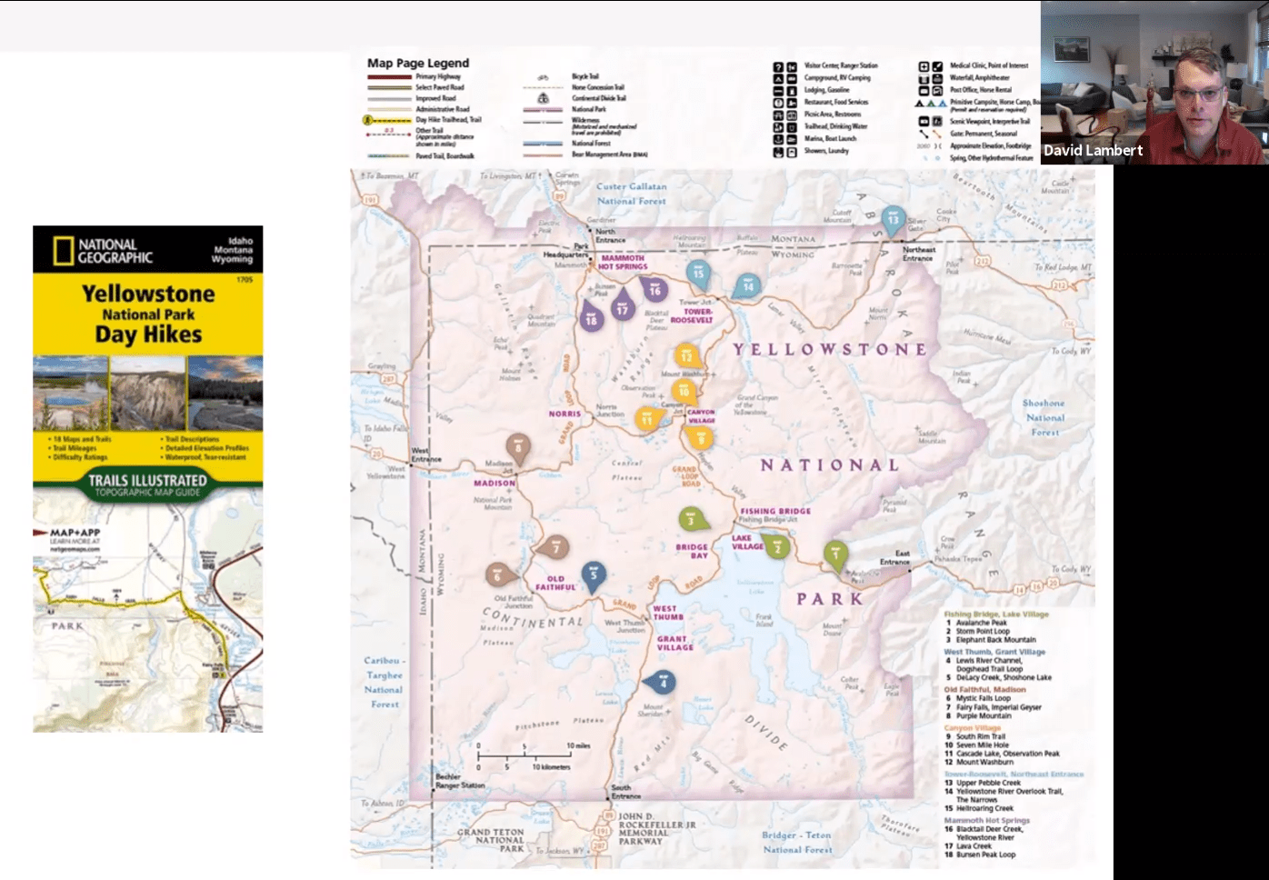 “How do you make a topographic map product more approachable for the casual user?” Matthews asked. “This was the magic question the production team and I continually asked ourselves during the development of this day hike series; we knew the booklet format would work well for hikers, but you would need trail descriptions and difficulty ratings too.”
His team worked closely with each national park to determine not only the best trails for each guide, but also what information would be useful for health and safety tips, for things such as bear encounters, waterfall hazards, or ticks.
“As cartographers, we’re always looking for ways to push boundaries a little bit, and not just place them on a map,” he said. “As recreation continues to grow, maps remain essential.”
Gaia GPS’ app-based analysis maps are sourced from a variety of vendors, including the Open Street Map project, National Geographic backroads map books, and federal and state agencies worldwide.
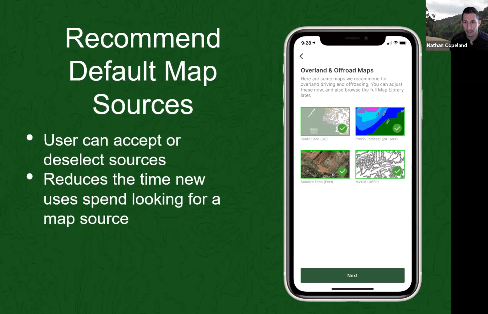 “When you put this all together sometimes that can be a little overwhelming for users or others who are just trying to find that right map for their activity,” said Copeland. “We found out we have backpackers, back country skiers, overland enthusiasts, search and rescue crews, hunters, natural scientists as users…and the common thread between them is that they have different needs and activities that will need different information, but you do not want to make the map too confusing, with unnecessary information for the user’s specific needs.”
With this in mind, Gaia GPS moved to using activity tags in their app, allowing users to select six main activity types. For example, “we start off with 200 different layers of information with any map. If you select hunting as an activity, there will be four main layers, and then once you select which state you are going to be hunting in, the information narrows down,” said Copeland. With such customizable data, users will find the app and the maps much more useful, making their outdoor experience that much more enjoyable.
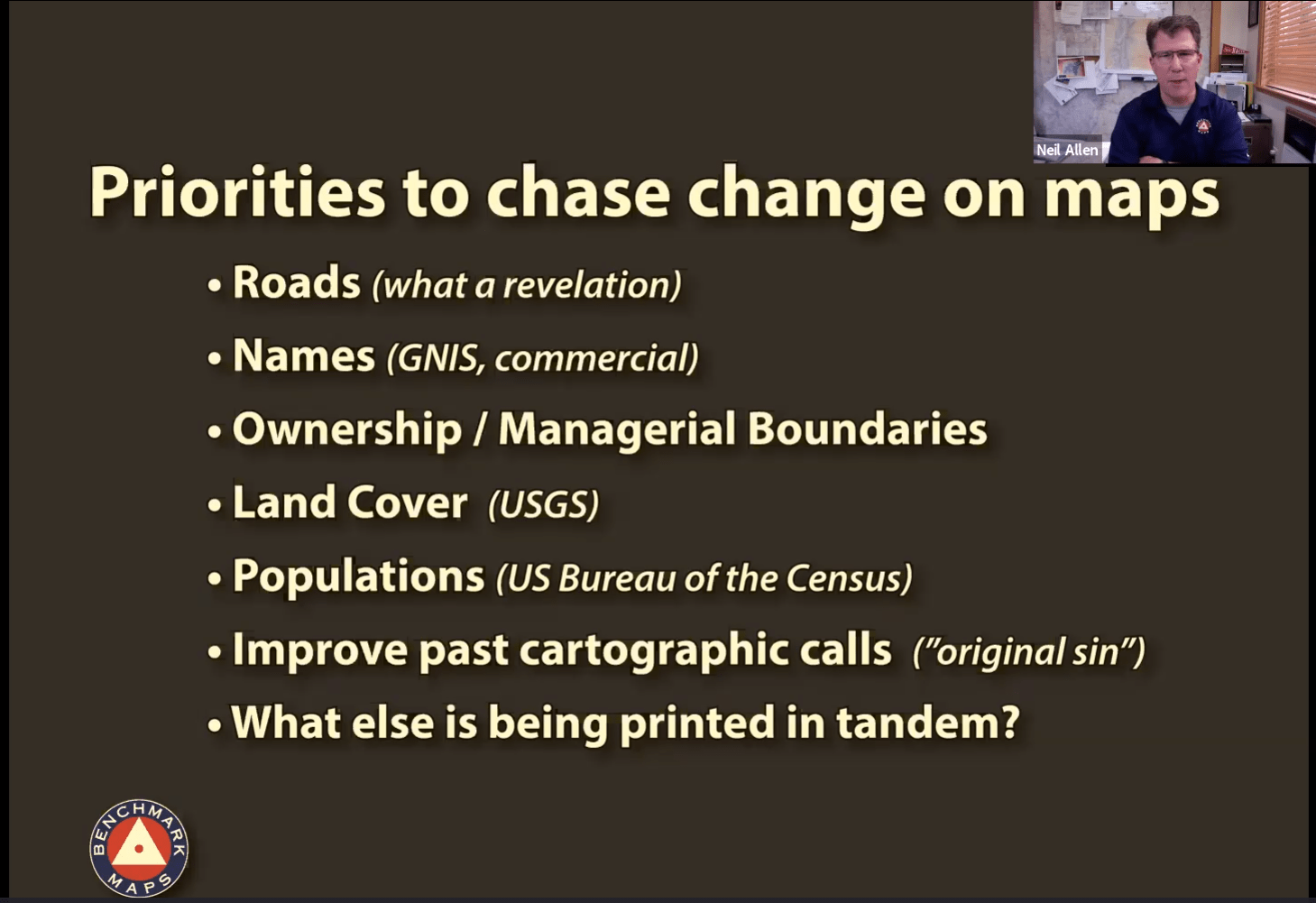 Allen reflected back on Benchmark Maps 25 years in business by tracking the evolution of one particular landscape map over the decades. Benchmark, which started as a recreation analysis group and also produced folded maps, expanded over the years to digital offerings as well as print-on-demand wall maps. The evolution of their products is informed by what is going on in the marketplace as well as comments they get from users. The availability of digital data that has exploded over the past 25 years has only improved products.
As a case study, Allen spoke about Benchmark’s very first product in 1995, the New Mexico Road Recreation Atlas, now in its 10th edition.
“Back then, all the data was manually derived,” said Allen. “Our current standard now is to have a large set of landscape maps and a smaller set of rec maps; back then the recreation maps were a parallel or identical set of maps with just a different background.”
Over the decades, the availability of digital data, along with the development of tools like Google Earth has kept Benchmark evolving.
“We’re constantly rethinking and trying to reinvent the way the content is displayed,” said Allen.