National Geographic MapMaker: Interactive Mapping for Students
At the International Map Industry Association (IMIA) we have been intentional to include people from various backgrounds and been purposeful in raising up the next generation of cartographers. There is no better way to do this than to reach people when they are still in primary and secondary school.
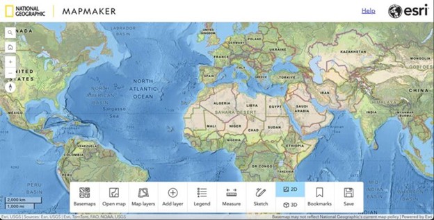 Since the 1990s, Esri and the National Geographic Society have enhanced map-based education by integrating geographic information system (GIS) technology into classrooms. The latest initiative, National Geographic MapMaker, is an intuitive online tool that connects users and classrooms with geographic data, allowing them to navigate, analyze, and visualize complex datasets. In a recent discussion, Esri president Jack Dangermond and National Geographic CEO Jill Tiefenthaler highlighted MapMaker’s ability to solve problems and tell compelling stories, making GIS accessible and engaging for students and educators alike.
Access MapMaker to try it yourself and explore its updated features:
- Enhanced Storytelling: Sketch layers now support pop-ups with titles, images, and descriptions to create more informative and interactive maps
- Improved Sharing: An updated URL system that makes it easier to share any map directly from your browser
- New Datasets: Seafloor Crustal Age, Watersheds, Internet Connectivity in the United States, Ocean Currents in Motion, and El Niño Southern Oscillation
- Updated layers: Sea Surface Temperature and Water Risk Index
Want to explore MapMaker’s capabilities? Visit MapMaker for access, resources and more.
For additional insights:
- Read a detailed feature review of MapMaker’s latest updates in our Esri Community blog.
- Watch “Esri and National Geographic Champion the Creative Power of Maps,” featuring Esri President Jack Dangermond and National Geographic CEO Jill Tiefenthaler.