
United States National Trails System
National Geographic Maps releases National Trails of the United States

America’s National Trail System began with the passing of the National Trails System Act in 1968, designating its first two national scenic trails, the Appalachian and Pacific Crest trails. By 1978, the system expanded with the National Parks and Recreation Act to include another national scenic trail (the Continental Divide Trail) and four national historic trails (Oregon, Mormon Pioneer, Iditarod, and Lewis and Clark).
In addition to the long-distance and often remote nature of the national scenic and historic trails, national recreation trails (NRTs) provide recreation opportunities closer to urban and rural communities. NRTs are preexisting trails designated to promote outdoor recreation and local tourism on land and water.
Today, there are 11 National Scenic Trails, 21 National Historic Trails, 1 National Geologic Trail, more than 1,300 National Recreation and National Water Trails with more being designated each year.
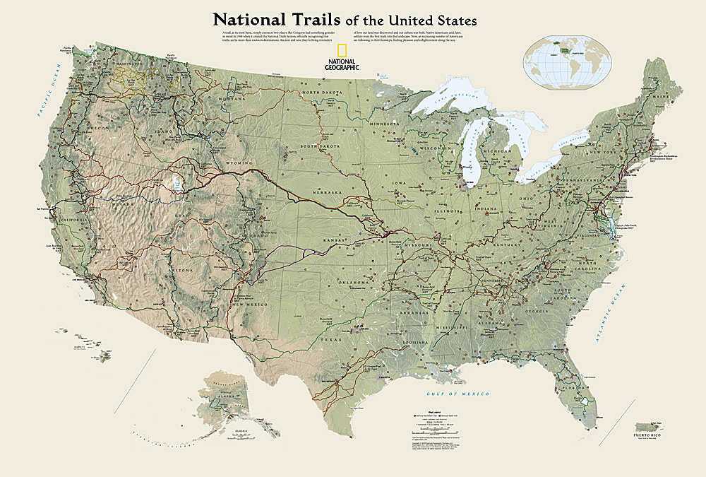
Rarely, has the United States Trails System been shown in its entirety on a printed map, but with more than half of the country’s population living within 60 miles of a national trail, the cartography team at National Geographic wanted to do just that, and inspire everyone to get outside and find their own path.
National Geographic provides accurate and reliable trail maps for many of the National Trails. Our trail map catalog encompasses over 400+ products that cover iconic national parks, vast wilderness areas, and other lesser-known but equally stunning recreation areas.
For more information about National Geographic Maps and its full line of outdoor, travel, and reference maps, visit NatGeoMaps.com or NatGeo.com/Maps.