
As the COVID-19 pandemic continues around the world, we’ve all become familiar with stories of social isolation and sacrifice, or the heroic healthcare professionals fighting on the front lines. A less-often told story, though, is that of the legions of mapping and geographic information systems (GIS) professionals, like you, helping to coordinate response efforts. These men and women are working day and night to map the pandemic and its many ramifications, informing decision-makers and communicating to a global audience about the extent and progression of the COVID-19 pandemic.
Esri has provided an informative StoryMap App that tells part of this story and provides resources so you can join the story too. It includes at least five stories or resources under each of the following areas:
- Five Steps centered on maps that any organization or individual can take now
- Hubs – robust data portals that focus on specific issues around communities
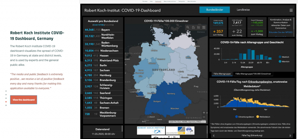
- Dashboards – User designed and daily maintained
- Maps, models and more
- Taking Action by
- Preparing data
- Analyzing risk
- Modeling disease spread
- Assessing social distancing
- Determining capacity
- Allocating resources
- More information, including resources and a personal video message from Jack Dangermond
Learn more about the StoryMap App.