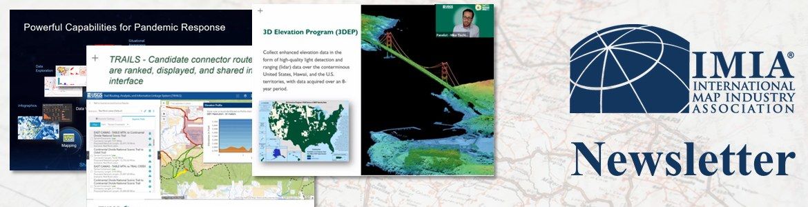
Mapping Leaders Virtual Forum
Thank you again to the presenters, attendees and sponsors who made last month’s Mapping Leaders Virtual Forum such a success! If you missed any of the three sessions (or if you want to refresh your memory) read the summaries and watch the videos below.
Government Session – September 16, 2020
IMIA’s 2020 Mapping Leaders Virtual Forum Series kicked off with the Government session on Sept. 16, sponsored by Esri. Speakers Jim Castagneri, Geographic Coordinator at U.S. Census Bureau; Janice Sharpe, Senior Director, Federal Geospatial Platform, Canada Centre for Mapping and Earth Observation at Natural Resources Canada and Dr. Michael Tischler, Director, National Geospatial Program at USGS shared the latest developments in open data applications and discussed the varied effects of COVID-19 on their government agencies.
For Castagneri and the Census Bureau, 2020 has been a tough year. “This will be my fourth census and it’s been the most challenging,” said Castagneri.
Between court cases and political arguments over the inclusion of undocumented residents and the arrival of COVID-19 in March, the Bureau had to make numerous adjustments to their collection efforts.
Recreation Session – September 23, 2020
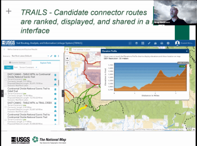
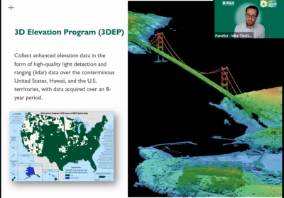
The second session of the Forum, held on Sept. 23, focused on trends and issues in the recreation world. Sponsored by National Geographic, the panelists were: Greg Matthews, UE Published Maps Products & Services Focus Area Coordinator, USGS; David Lambert, Director of Cartographic Production, National Geographic Maps; Nathan Copeland, Gaia GPS; and Neil Allen, Director of Cartography, Benchmark Maps.
Matthews kicked off the session discussing the National Digital Trails project at the USGS.
“This initiative was launched in 2018 to increase public access to land, and to provide better connectivity on the nation’s trail systems by providing data and tools,” explained Matthews, with the goal of “enabling land managers to visualize opportunities to increase connectivity within this network, expanding recreational opportunities.”
Technology Session – September 30, 2020

The 2020 Forum Series’ final session on Sept. 30, sponsored by NextByte Technologies, focused on technology-related issues in mapping. The panelists were: Dr. Este Geraghty, Chief Medical Officer, Esri; Dale Lutz, Co-Founder and Vice President of Software Development at Safe Software Inc.; and Dennis Nazarenko, Co-Founder and Vice President of Clear Sky Connect.
Geraghty spoke about how GIS has been used to support the world during the COVID-19 pandemic. “We saw tremendous use of data science to really understand disease spread and resource allocation, while also monitoring intervention performance,” said Geraghty. “In times where there were not existing data resources, organizations used mobile collection tools to quickly start to gather important information. Esri helped groups to use GIS dashboards to be more successful in their efforts, which began with mapping the cases and the spatial and temporal spread of disease.”
The best-known example is the Johns Hopkins University COVID-19 dashboard, which since launching in January 2020 has been accessed as many as 2 trillion times, achieving, as Geraghty said, “a special place in history as the most viral GIS app the world has ever seen.”

Industry News

GIS Day is November 18, 2020
GIS day is November 18, 2020, part of National Geography Week! Take a look at these 101 ways that you can participate in GIS Day next month. Share your passion and inspire the world with GIS .

GIS Is Powering Solutions To Global Challenges
On a crisp day in the American West, scientist Dr. Rae Wynn-Grant gingerly steps toward the water to study how a black bear, perched on the other side of the riverbank, teaches her three cubs how to fish.

